I Drew a Terrible Congressional Redistricting Map Just to Make a Point
If you're gonna make a point, do it with panache right?
I’ve expressed more than once how much I love the fact that the Maryland Citizens Redistricting Commission is using a portal to allow citizens to submit their own Congressional and Legislative Redistricting Maps. It’s awesome and allows people to submit good maps, bad maps and everything in between.
It’s probably not a coincidence the the kangaroo court that is the Maryland Legislative Redistricting Commission is not using some sort of citizen submission portal. In fact, I’m not even sure they have a website. As far as I can tell, the only public available information about how to submit testimony is listed here at this PDF file that I only found because it was in the description of a Bill Ferguson Instagram post.
It’s almost like Senate President Bill Ferguson and Speaker Adrienne Jones don’t actually what public input because they have already baked the cake with their predetermined preferred districts drawn by Democratic political hacks. But I digress.
With the existence of the Portal it gives people like me an opportunity to get involved and submit district proposals. Which I have done. I have submitted a serious Congressional and Legislative (Senate, at least) redistricting plan. I’ll let you figure out which one it is.
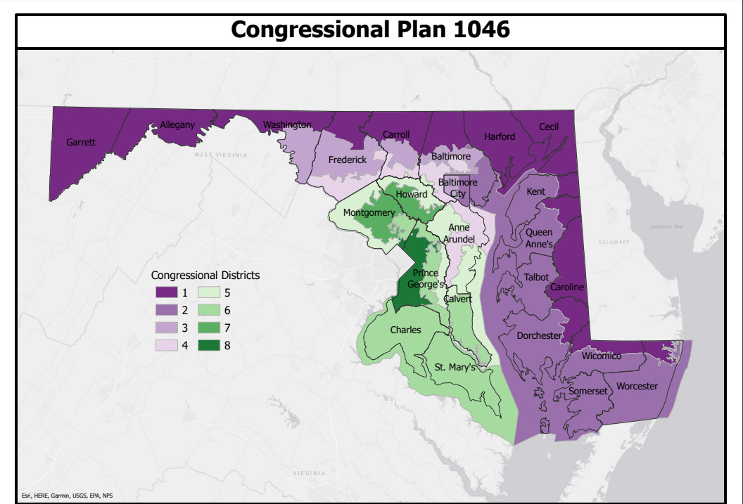
But I also submitted this monstrosity.
Seriously, look at this horror show. Ever see a district that connects West Virginia to the Atlantic Ocean? Frederick County with Lothian? Hagerstown to West Baltimore? And that says nothing of District 5, meandering from the DC lines, through Northern Montgomery and Howard Counties, through Crofton into Prince George’s County and then back up to Edgewater.
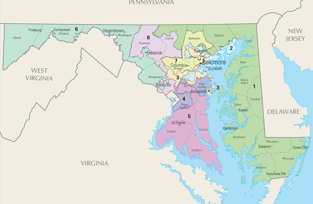
This map is hideous. And yet, does it look *all* that different from this
Those of course are our current districts, which slice and dice up the state of Maryland to meet our political needs.
So why did I submit this map? Here’s my comments I submitted to the Commission about this map:
I created this map ONLY to demonstrate how ridiculous our current laws are on redistricting. The Maryland Citizens Redistricting Commission is doing a great job of showing Marylanders how it should be done.
This map on the other hand shows what can happen when the redistricting process is abused.
This map is a ridiculous example of what partisanship gone wild could look like chopping up the entire state to meet some political purpose.
This map is ONLY to illustrate those purposes.
And that really is the point. Until we have actual, comprehensive, permanent redistricting reform, my awful map is something that could happen. And so is something similar to the 2011 Map. Governor Larry Hogan’s efforts in appoint the Maryland Citizens Redistricting Commission is important and meaningful work. But Democrats still haven’t done anything to bring about real redistricting reform. Sure, they did a cosmetic thing four years ago which has already expired and failed exactly like I said it would. But partisan gerrymandering? It’s still a key component of the Democratic playbook, for both Congressional and Legislative Districts.
Think of my hideous map as performance art. Performance art in protest of the Maryland Democrats and their hyperpartisan gerrymandering.


